Image

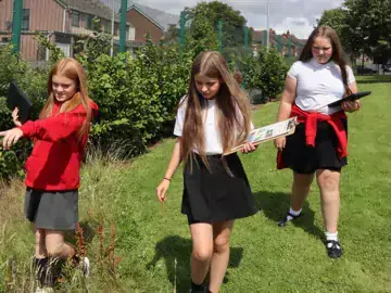
What are the different factors that might affect what nature we find on a school site? How can we record them so that we can consider them when making decisions about the best ways to enhance school grounds for people and for nature? In this activity educators and young people can work together to build up knowledge about their education site using digital technology, as well as developing key skills of data collection and observation.
If you can't see the link to start this activity make sure you are registered and logged in to access it and track your progress.
This activity works well in combination with activities in Start Planning for Nature as well as Investigate Environmental Quality.
Identifying opportunities
Outdoors with indoor follow up
The following links to the Met Office offer guidance on how to collect the data specified in the survey
How we measure cloud
Beaufort wind force scale
Measuring humidity
Make your own wind vane
A microclimate exists when the climate in a small area is sufficiently different to the climate in the larger area around it as to be distinct.
Using a simple app based tool learners of different ages can be supported to collect and interpret the following information about microclimates on the school site (compulsory fields are marked with *):
For learners at this age we suggest that teachers explain the concept of microclimate in two contrasting locations on the school site and follow up with at least two temperature readings to add to the app and linked map. KS2 learners may be able collect and compare readings in several locations. Learners can collect further information, but the other data fields are not compulsory.
Learners should be competent in the geographical skills needed to collect, analyse and communicate with a range of data gathered through experiences of fieldwork that deepen their understanding of geographical processes and be able to interpret a range of sources of geographical information, including maps, diagrams, globes, aerial photographs and Geographical Information Systems (GIS). Their interpretation of the final GIS map is one of these key skills.
At this age, learners can undertake a detailed microclimate survey of their school grounds, view the results on the resulting map and draw conclusions.
They should work out the range of each of the readings collected and suggest why it may be useful to have this information to use at a later stage when they are considering what changes could be made to enhance biodiversity as part of the Nature Park process (eg when planting new plants on site).
Learners can also compare their results to other readings that will be gathered and presented on the live map from schools across England.
At Key Stage 3 learners should use Geographical Information Systems (GIS) to view, analyse and interpret places and data. They should also use fieldwork in contrasting locations to collect, analyse and draw conclusions from geographical data, using multiple sources of increasingly complex information.
At GCSE, students should develop and extend their competence in a range of skills including those used in fieldwork, in using maps and Geographical Information Systems (GIS) and in researching secondary evidence, including digital sources; and develop their competence in applying sound enquiry and investigative approaches to questions and hypotheses (study like a geographer).
They should also apply geographical knowledge, understanding, skills and approaches appropriately and creatively to real world contexts, including fieldwork, and to contemporary situations and issues; and develop well-evidenced arguments drawing on their geographical knowledge and understanding (applying geography). GCSE specifications also provide opportunities for students to understand changing weather and climate.
This activity can be used to support curriculum knowledge and skill development in geography, alongside enhancing nature education, with age appropriate adaptations.