Mapping our site: a primary school perspective
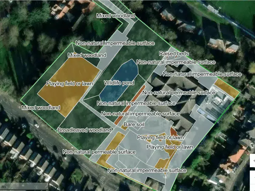
One of the first things you’ll complete as part of the Nature Park program is mapping your school site. This is crucial for understanding what you have already and where you might be able to turn grey areas green. However, this task can seem a little daunting at first. Here’s a few tips that helped us get started with our site map.
It doesn’t need to be done in one go!
We did the activities in small chunks across a period of time. For example, I completed the tree mapping activity with a child who needed some time to regulate and who benefitted from a task which gave him a distraction. There’s no “right” or “wrong” way to do it.
Integrate it with the curriculum where you can
Year 2 had to complete a piece of fieldwork in which they planned a route around the site and had to note down how many times they saw a particular feature. This was a great way to map some of the “green” features we already had on site, such as raised beds and microhabitats.
Share the load
Think about whether different year groups could complete different aspects of the mapping. For example, activities such as counting trees can be done relatively easily in KS1, whereas identifying whether surfaces are permeable or not might be better completed by children in KS2.
Remember - the kids don’t need to be able to do it perfectly!
I’m slightly embarrassed to admit that one of the things that slowed me down at the start was thinking that the children needed to be able to do it perfectly themselves and fretting about teaching them to do things absolutely right. This, of course, is not the case. Particularly in the early year groups of primary school, they’re learning to survey for the first time and it’s absolutely fine for them to have a good go while you or another adult counts to check that you’ve got an accurate figure for your map.
Montrose Primary School's first year of the Nature Park

Will spoke to us all about what his pupils had been up to through the Nature Park programme, including how they are turning their outside space from grey to green and the benefits they've seen for both wildlife and the school community.