Mapping tree habitats

Trees are incredible living things that are a vital part of our environment. They provide shelter and habitats for other organisms, provide cooling shade, filter water, stop erosion, convert solar energy into stored carbon, provide energy when burned and are an important building material.

This session will guide learners through a series of activities, supporting them to explore the difference between evergreen and broadleaf trees, and identify what kind of woodland they have before using a flowchart to identify the exact habitat, which will form an important piece of your overall Nature Park map. 

Lesson plans
KS2
KS3
Science
Geography

Preparation

What you need 
  • printed flowcharts and worksheets
  • clipboards
  • drawing materials
  • measuring tape or measuring sticks
  • tablet, laptop, or computer to access the online Habitat Mapper tool
  • printed map of your site, if you do not intend to use the Habitat Mapper outdoors
  • optional: examples of broadleaf leaves (e.g. oak, ash or beech) and examples of evergreen leaves (e.g. conifer) 
Location

Outdoors, at any time of year

Useful guidance  

Step by step

  1. Ask learners to work in small groups (three works well) and ask them to choose a tree. Give each group a Meet a tree Worksheet.
  2. Give learners no more than two minutes to either observe and sketch the tree, the leaves or make a bark rubbing on their worksheet. Remind them that it does not need to be perfect!
  3. Next, the worksheet will guide learners to estimate the life stage of the tree. Ask them to look at the height of the tree, the thickness of the trunk and the texture of the bark.
  4. Then ask learners to observe the shape of the tree’s leaves and discuss whether the tree is evergreen or broadleaved using the third section of the worksheet.
  5. Consider what fruits, nuts or seeds the tree produces. Discuss whether humans or other animals can eat these. Do not eat any fruits or nuts unless you can positively identify them as edible and be mindful of possible nut allergies.
  6. Encourage the learners to look at how the tree fits into its surroundings. Does it stand alone, or with other trees?  If there are five or more trees in a group, complete the Tree survey (the second worksheet in the download) to identify what kind of woodland you have.
  7. If there are fewer than 10 trees, investigate all the trees in that area. If there are more, ask learners to choose 10 trees at random. A random sample is important to create a fair representation of tree types within the woodland area. Following the survey sheet, ask learners tally the number of broadleaved and evergreen trees and identify whether the woodland is evergreen, broadleaved or mixed.
  8. Then, each group can use the Trees habitat flowchart, answering each question to reach a decision on which tree habitat you should add to your map. Repeat this for each area of trees on your site, as they may be different types.
  9. If using a printed map of your site: ask learners to draw and label the habitat they have just identified on the map. If using the Habitat Mapper tool on a mobile device: educators and learners can work together to add the habitat to the map.  
  10. If you used a printed map, remember to add the habitats identified to the Nature Park map using the Habitat Mapper tool when you are back in the classroom. This is a really important step to ensure your site and your observations contribute to real-world, groundbreaking research by the Natural History Museum into nature recovery. 

Open Habitat Mapper tool

Reflection

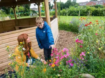
The type of tree influences how much light reaches the ground, how deep the leaf litter layer is and the acidity of the soil, all of which determines what organisms live in the habitat. Challenge learners to make a list of organisms that might rely on trees and ask if they saw any while surveying.