Students lead the way in mapping habitats at Reading School
At Reading School in Berkshire - a secondary school with 1,150 students - young people have been planning, leading and carrying out habitat mapping activities as they get started with their Nature Park journey.
In the Nature Park habitat mapping activities, learners can use flow charts to understand and map the habitats they see on their sites. Doing this gives learners and school staff evidence and information to help decide how to make the best changes for both nature and the school community on their sites. At Reading School, they took an approach which allowed students to take on as much responsibility for this as possible, emphasising a sense of independent exploration and agency, and developing their green, digital, and scientific skills.
...A great opportunity to discover how many hidden habitats there actually are, such as plant pots and log piles. I was amazed by the number and variety of names there are for parts of the environment we see daily, like types of ground and even puddles. The experience of identifying certain sections of the landscape, as well as objects within it, was really fun and it also brought with it an increased knowledge and understanding about our natural surroundings.
Reading School student
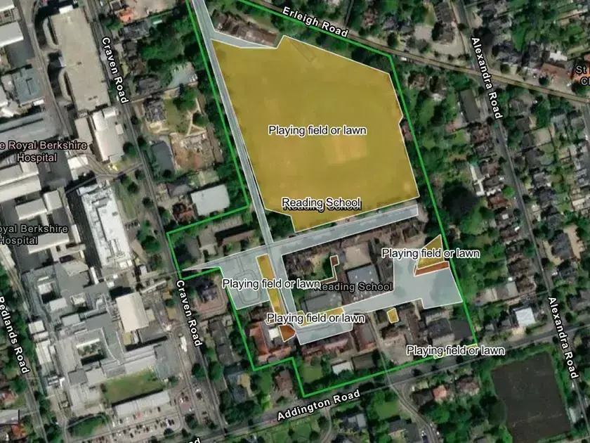
The outdoor spaces students explored and understood include a tree-lined driveway, a school field and a nearby sports field that serve the student and staff communities. Some of the outdoor spaces are developed with sealed surfaces and others contain trees, shrubs and planting. What they found has given them lots of ideas of how they want to improve their school's outdoor space in the future.
Kees Luteijn, Sustainability Lead at Reading School, spoke to us about their experiences of habitat mapping.
How did you plan the habitat mapping activity with your staff and students?
The activity was led by our Y13 Environment Prefect, and supported by a member of staff. In preparation for the activity, the prefect planned a sampling strategy to enable us to accurately and efficiently map the main site in one after-school session. The session was open to any students who wanted to help out. We utilised the flow charts available on the National Education Nature Park website to help students quickly identify the different types of habitat. Following the session, once all the data had been collected the prefect collated this and worked with the member of staff to add this data to the database using the Habitat Mapper tool.
What are your hopes for nature and the school community through the Nature Park programme?
We hope to continue to monitor the biodiversity of the school site and increase this over time. We hope that being part of the Nature Park will help to give us a framework to support students to increase the natural health of the school and provide additional opportunities for students.
“Using the habitat map we identified the places that will benefit most from improving biodiversity. A team of us and one of the House Sustainability Champions are now working on developing a plan to improve these by doing things such as planting new types of plant and changing how we use areas of land”
Reading School student
Get involved
Learning about the biodiversity and climate crises can be overwhelming for adults and young people alike, but enabling learners to build agency and take the lead can be an important way to provide a powerful antidote to this. This is a key consideration in all Nature Park activities and curriculum content - you can explore the habitat mapping and the rest of our resource library here.